A collection of various GIS related links, information and other GIS blogs.

Showing posts with label Related Technologies. Show all posts

Wednesday, September 08, 2010

Get rid of it!

Been seeing this abandoned truck on the side of the road for about 3 months. Doors off, a real mess – who knows how long it has been sitting there. Looked like a real long time.

I finally had a chance to pull over and make a CitySourced report about it on Sept 5th.

Here is my report with photo to CitySourced: http://www.citysourced.com/report/6906/abandoned-vehicle 

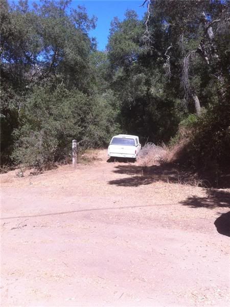
Abandoned Vehicle - Issue Reported in Valley Center, CA 
Reported On: 09/05/2010 @ 03:04 PM
Reported By: Anonymous
Address: 29845-29999 Anthony Rd, Valley Center, CA 92082, USA
Latitude: 33.251583
Longitude: -117.050011
Direction: North
Description: Truck about 60 feet east of Anthony Road. Looks like it has been here a long time.
Device: Apple iPhone 4
Current Status: Submitted


I drove by the spot 2 days later and noticed that it was gone!

Was totally (happily) surprised to see it gone. Fantastic! I had hoped my report would lead to it being taken away, but didn’t think it would be so fast.

Take a look at CitySourced and help make your community a better place by reporting issues around your neighborhood: http://www.citysourced.com/ 

Happy CitySourcing!

Tuesday, May 19, 2009

Tweet Tweet

Been using Twitter now for a few months. “Micro-Blogging” yet so very different from a blog. Been through a few desktop applications to better my Twitter experience, but was still using http://twitter.com when out and about on my Windows Mobile device. I knew there had to be something better.

Where to turn? To Twitter of course! I had seen folks Tweeting about different applications for the Blackberry – then did see a series of Tweets about Windows Mobile – this is where I learned about Twikini.

So I grabbed the beta and liked it right away. Easy to use, and code updates often with new features. I’m really liking it. Be sure to check out the menus as there are lots of features in there. Also see the main features here.

You can even add your location information to your Tweets:

image

If you are on Twitter and have a Windows Mobile device, I recommend that you take a look at Twikini. Oh ya – if you are interested in following me, I am @Tim_Craig

Sunday, March 29, 2009

ESRI Developer Summit – Lots of News

The ESRI Developer Summit took place last week in Palm Springs, following right on the heels of the Business Partner Conference.

Like many of you, I was not there. But sometimes I felt like I was just from following all the action on Twitter. Folks were sending a fair number of tweets during the BPC. But it was during the Developer Summit that the Twitter action really took off! Interested in seeing what was discussed? You can follow the hash tag for the Summit - #devsummit.

Keep an eye on the Developer Summit events page on ESRI.com – they have already posted some video, and more will be available in the coming weeks.

There have also been a lot of attendees posting on their blogs about the event:

Another fantastic resource that many of the #devsummit presenters have taken advantage of is the slideshare site. In particular there has been a tag created here for “esri” & one for “devsummit” as well – so you can find all all of the presentations in one place. There is some good stuff here – even without the presenter.

If you know of any blog posts or other interesting Developer Summit related resources that should be listed here, please leave a comment and let me know. Thanks!

Follow me on Twitter @Tim_Craig

Thursday, March 26, 2009

ESRI / Microsoft Virtual Earth Partnership Announced

This week during the Environmental Systems Research Institute Developer Conference in Palm Springs, CA, ESRI announced their extended partnership with Microsoft’s Virtual Earth business unit granting native access to Virtual Earth’s imagery and road network map data within ArcGIS Desktop and Server. How’s that for a footprint? At the very least it makes the GIS world a bit more interesting, no?

See blog post on MSDN for the official announcement!

Wednesday, February 11, 2009

Opening the Landsat Archive

[ I thought some folks out there might find this of interest in case they weren’t notified ]

Electronic access to the entire USGS Landsat 7 archive, enabling users to download standard-format scenes at no charge, has been an amazing success, with over 225,000 scenes downloaded since October 1, 2008.

Previously acquired imagery from Landsat 1 through Landsat 5, is also now available for download at no charge using the same standard processing format. Processing parameters and other details about the products can be found at http://landsat.usgs.gov/products_data_at_no_charge.php

<http://landsat.usgs.gov/products_data_at_no_charge.php> .

Previously offered USGS Landsat products with customer-defined options, including media, are no longer available.

Newly acquired Landsat 7 ETM+ SLC-off and Landsat 5 TM images with less than 40 percent cloud cover are automatically processed and made available for immediate download. Imagery with greater than 40 percent cloud cover can be processed upon request. Once the requested scenes are processed, an email notification is sent to the customer with instructions for downloading. These scenes will then become accessible to all users.

Landsat data can be searched, downloaded, or requested from GloVis or EarthExplorer. High demand for this data may result in slow search performance and processing times, which typically range from 1-3 days for Landsat 7 ETM+ and some Landsat 5 TM data and 3-4 weeks for Landsat

1-5 MSS, Landsat 4 TM and some Landsat 5 TM data. Please contact Customer Service at custserv@usgs.gov with any comments or questions.

Landsat scenes can be requested and downloaded from Glovis (http://glovis.usgs.gov <http://glovis.usgs.gov/> ) or Earth Explorer (http://earthexplorer.usgs.gov <http://earthexplorer.usgs.gov/> ).

Friday, January 30, 2009

“GIS is a Green Technology” – new white paper available

GIS Supports Global Green Initiatives

With the growing unease and awareness among large segments of the population that remedial
action must be taken to resolve the many environmental crises we now face, GIS solutions are
currently being implemented around the world that provide the technological and scientifi c support
necessary to create programs and processes designed to return our planet to a more sustainable
and balanced level of use.

Whether increasing the effi ciency of fl eet vehicles by optimizing standard routes and subsequently
reducing fuel consumption or determining the optimum location for a wind farm to produce energy
with minimal pollution, GIS provides the quantifi ed information and analytical capabilities necessary
to make decisions that can both support growth and reduce consumption.
The visualization capabilities of GIS afford a unique way of examining things that promotes creative
out-of-the-box thinking, providing insight and solutions that are not so apparent in written reports
and tabular data. Often, an existing GIS implementation stimulates the need to modify existing
business practices or apply new ones that lead to savings in both costs and resources.

The stories included in this e-book detail GIS-based applications for innovative, sustainable
solutions to many of today's common environmental problems. Cascade County, Montana, uses
GIS to map the optimum locations for wind farms and promote investment in this "green" energy
source. Buffalo, New York, known as the City of Trees, maintains its urban forest inventory with
GIS. Air pollution in Jakarta, Indonesia, is severe; in 2004, 46 percent of all illness in the city was
respiratory related, but backed by GIS-based scientifi c studies, the government has implemented
an ambitious plan to improve air quality. The release of carbon dioxide (CO2) into the atmosphere
is the fundamental cause of global warming; GIS is being used in the study and implementation of
CO2 sequestration programs, which either capture the pollutant at its source or absorb it through the
planting of vegetation. The U.S. Army Corps of Engineers used GIS to restore the natural habitat
of the Middle Rio Grande in New Mexico, and the City of Boston, Massachusetts, is implementing
an ambitious solar energy program by using GIS to calculate the solar radiation available on city
rooftops.

As ESRI president Jack Dangermond has often said, "The application of GIS is only limited by the
imagination." GIS Is a Green Technology provides an introduction to the powerful capabilities of the
software when applied to environmental and sustainability issues as well as the ingenuity of those
developing these innovative applications.

Get the 50-page PDF here: http://www.esri.com/library/bestpractices/gis-is-green.pdf

Thursday, January 29, 2009

Funny, Sad and Interesting – all at the same time…

You have got to take a look at this blog posting on GIZMODO – it is…interesting…

Google Maps Car Hits a Deer, Records Entire Ordeal on Google Maps

Maybe not “real time” data – but certainly real!

Tuesday, December 09, 2008

FOXNews – Google Earth Accused of Aiding Mumbai Terror Attacks

http://www.foxnews.com/story/0,2933,464246,00.html 

An Indian court has been called to ban Google Earth amid suggestions the online satellite-imaging service was used to help plan the terror attacks that killed more than 170 people in Mumbai last month.

A petition entered at the Mumbai High Court alleges that the Google Earth service "aids terrorists in plotting attacks."

Advocate Amit Karkhanis has urged the court to direct Google to blur images of sensitive areas in the country until the case is decided.

There are indications that the gunmen who stormed Mumbai on Nov. 26, and the people who trained them, were technically skilled.

The group appears to have used complex GPS systems to navigate their way to Mumbai by sea. They communicated by satellite phone, used mobile phones with several different SIM cards and may have monitored events as the siege unfolded via BlackBerry Web browsers.

Police in Mumbai have said the terrorists familiarized themselves with the streets of Mumbai's financial capital using satellite images, according to the sole gunman to be captured alive.

The commandos who stormed the Taj Mahal Palace hotel in Mumbai said the militants had made a beeline for the building's closed-circuit security-camera control room.

The legal petition also follows unconfirmed reports that Faheem Ahmed Ansari, a suspected militant who was arrested in the northern state of Uttar Pradesh in February, said he was shown maps of Indian locations on Google Earth by members of Lashkar-e-Taiba, the Pakistan-based terrorist faction that Indian officials are convinced was behind the Mumbai attacks.

Saturday, November 22, 2008

Microsoft & ESRI team to geo-enhance FusionX

Watch for more on this in 2009.

---------------------

November 20, 2008

Microsoft, ESRI to Help Improve Homeland Security Operations

Technology partnership in FusionX makes fusion center situational analysis affordable, easy to use.

Redmond, Washington, and Redlands, California—Microsoft Corp. and ESRI together are driving Homeland Security innovations to more effectively help protect citizens, prevent and solve crimes, and enable counter-terrorism through software. The newly formed collaboration will combine the best capabilities from both organizations in geospatial and collaborative technologies, and will result in advanced intelligence for state and local data fusion centers and emergency operations centers.

An intended product of this collaboration is the FusionX Appliance, a baseline IT architecture for fusion centers, which will provide users with advanced collaboration and geospatial intelligence capabilities by combining the power of ESRI’s ArcGIS Server Advanced Enterprise with the collaboration capabilities of Microsoft Office SharePoint Server 2007.

FusionX will enable homeland security and law enforcement personnel to analyze previously disparate data sets in a mapping context and easily share that information in near real time with relevant stakeholders. FusionX will enhance the abilities of fusion center directors at the strategic and tactical level, enabling them to visualize patterns and trends to help prevent future acts of terrorism and crime, and facilitate a faster and more informed response when necessary. Through the intake of raw data such as fire, police and citizen reports, FusionX will allow for geocoding and mapping of the data to help detect man-made acts of terrorism and crime, such as organized, gang and drug-related activity. Critical GIS data is made accessible and shareable, replacing current collaborative analysis methods that rely on paper exchange and e-mail.

The IT architectural features of the appliance include the following:

  • Sophisticated management dashboards through the advanced monitoring, modeling, analysis and planning capabilities of ArcGIS Server and Microsoft Office PerformancePoint Server 2007
  • ESRI ArcGIS Server Advanced Enterprise, Microsoft Office SharePoint Server 2007, Microsoft Office PerformancePoint Server 2007, Microsoft SQL Server 2008 and access to terabytes of high-quality pre-rendered base maps and imagery
  • An advanced situational awareness portal with support for GeoRSS feeds, Keyhole Markup Language (KML) feeds and other data that will be integrated in the SharePoint environment for access control features and information sharing
  • Best practices and foundational content specific to anticipated operator and analyst requirements. Customers will be able to customize the software as necessary, but the goal is to deliver capability that is usable after only minimal configuration.

Our police forces, sheriff departments and fusion center managers are increasingly relying on collaboration tools that help them connect the dots in a world of asymmetrical threats," said Gail Thomas-Flynn, general manager of State and Local Government at Microsoft. "Microsoft and ESRI’s FusionX Appliance provides the layman- to expert-level technology that can facilitate the intake, analysis, visualization and dissemination of information to the right person, at the right time, in the right place."

The FusionX Appliance will deliver advanced geospatial and collaboration capability with minimal configuration and maximum ease of use, yet at an affordable price. It will be extensible so as to grow with the needs of an individual customer. The FusionX Appliance also will allow for the scaling of its technology architecture framework to a broader set of federal, state and local domestic security and public safety agencies with capabilities such as geoprocessing and geoanalytics.

"We understand what it takes to provide secure and mission-critical capabilities in ways that leverage the technologies that many customers already own," said Russ Johnson, public safety industry manager at ESRI. "And that is extremely important in this economic climate."

More information about the program is available at http://www.microsoft.com/industry/government/solutions/FusionX/default.aspx.

# # #

About Microsoft
Founded in 1975, Microsoft (Nasdaq "MSFT") is the worldwide leader in software, services and solutions that help people and businesses realize their full potential.

Press Information:
Matt Donovan, Merritt Group
Tel.: (703) 390-1519
E-mail (press only): donovan@merrittgrp.com

Friday, September 19, 2008

ESRI & Google Earth at Where 2.0

From the ArcGIS Explorer blog

Explorer at Where 2.0

Earlier this morning here at Where 2.0 in San Francisco, John Hanke, Director of Google Earth and Maps, and Jack Dangermond, ESRI President, partnered in a presentation which showcased some of the capabilities of ArcGIS Server 9.3. ArcGIS Server was used to publish KML that was viewed in Google Earth. The KML showed the result of a fire model with predicted burn times from the current fire perimeter (red line at right).

While ArcGIS Explorer is tightly coupled with ArcGIS Server, and has been designed specifically to leverage ArcGIS Server capabilities, ESRI's open architecture also provides support for Google Earth, Google Maps, Virtual Earth, and other custom viewers.

Read the rest of the article here...

Thursday, August 14, 2008

Google Geo Developers Blog: Using Google Maps to Visualize ArcGIS Data & Services

[From the Google Geo Developers Blog]

Using Google Maps to Visualize ArcGIS Data & Services

Tuesday, August 12, 2008

Posted by Sterling Quinn, ESRI Developer

Hi, I’m Sterling Quinn and I work on the development team for server-based GIS technologies at ESRI in Redlands, California. We’re happy to report that ESRI software users can now expose their GIS in Google Maps through the recently-released ArcGIS JavaScript Extension for the Google Maps API. The extension is built on the Google Maps API and is designed to communicate with ArcGIS Server, ESRI’s product for serving GIS functionality on the Web.

The ArcGIS JavaScript Extension for the Google Maps API allows you to maintain the user-friendly front end of Google Maps while tapping into an advanced GIS on the back end. You can use the extension to display your own maps on top of Google’s, query features in your database and display them on the map, or expose tasks that run GIS analysis models on the server. You can display your results using the Google Maps API’s native graphics engine and info windows.

To learn how to use the ArcGIS JavaScript Extension for the Google Maps API, use the online SDK, which contains basic concepts, an API reference, and examples of how to create custom maps and Mapplets. The examples contain detailed descriptions on how to do things like adding an ArcGIS Server map type button, displaying query results as KML, or running a task on the server to return a route and elevation profile.

Following are some quick links to example Mapplets...follow the link below to the full story and links...

Google Geo Developers Blog: Using Google Maps to Visualize ArcGIS Data & Services

Monday, June 02, 2008

Google spotlights data center inner workings | Tech news blog - CNET News.com

Original post - May 30, 2008

Google spotlights data center inner workings

Posted by Stephen Shankland

SAN FRANCISCO--The inner workings of Google just became a little less secret.

The search colossus has shed only occasional light on its data center operations, but on Wednesday, Google fellow Jeff Dean turned a spotlight on some parts of the operation. Speaking to an overflowing crowd at the Google I/O conference here on Wednesday, Dean managed simultaneously to demystify Google a little while also showing just how exotic the company's infrastructure really is.

Google fellow Jeff Dean

Google fellow Jeff Dean
(Credit: Stephen Shankland/CNET News.com)

On the one hand, Google uses more-or-less ordinary servers. Processors, hard drives, memory--you know the drill.

On the other hand, Dean seemingly thinks clusters of 1,800 servers are pretty routine, if not exactly ho-hum. And the software company runs on top of that hardware, enabling a sub-half-second response to an ordinary Google search query that involves 700 to 1,000 servers, is another matter altogether.

Google doesn't reveal exactly how many servers it has, but I'd estimate it's easily in the hundreds of thousands. It puts 40 servers in each rack, Dean said, and by one reckoning, Google has 36 data centers across the globe. With 150 racks per data center, that would mean Google has more than 200,000 servers, and I'd guess it's far beyond that and growing every day.

Regardless of the true numbers, it's fascinating what Google has accomplished, in part by largely ignoring much of the conventional computing industry. Where even massive data centers such as the New York Stock Exchange or airline reservation systems use a lot of mainstream servers and software, Google largely builds its own technology.

I'm sure a number of server companies are sour about it, but Google clearly believes its technological destiny is best left in its own hands. Co-founder Larry Page encourages a "healthy disrespect for the impossible" at Google, according to Marissa Mayer, vice president of search products and user experience, in a speech Thursday.


Read more: Google spotlights data center inner workings | Tech news blog - CNET News.com

Friday, May 30, 2008

ArcGIS Explorer Blog : Timely information via GeoRSS - Sneak peek at Explorer 480


Timely information via GeoRSS - Sneak peek at Explorer 480

Cyclones in Myanmar. Fires in Florida. Earthquakes in China. Timely information is critical for learning about events as they happen, and subsequently how to respond and what to do in their aftermath. One of the ways that timely geographic information is published is via GeoRSS feeds.

In the upcoming Explorer 480 release GeoRSS feeds are one of the supported connections, joining ArcGIS Server, ArcIMS, and WMS.

Here we've connected to the USGS Shake Map feed, and we're showing the popup content for the 7.9 quake that hit China on Monday, May 12.

Read more: ArcGIS Explorer Blog : Timely information via GeoRSS - Sneak peek at Explorer 480

-

I've seen Geo RSS feeds in action and it looks like a nice way to share location information. I think we will be seeing more of this in use as we see more and more mashups popping up all over.

ArcGIS Explorer Blog : Explorer at Where 2.0


ArcGIS Explorer at Where 2.0

Earlier this morning here at Where 2.0 in San Francisco, John Hanke, Director of Google Earth and Maps, and Jack Dangermond, ESRI President, partnered in a presentation which showcased some of the capabilities of ArcGIS Server 9.3. ArcGIS Server was used to publish KML that was viewed in Google Earth. The KML showed the result of a fire model with predicted burn times from the current fire perimeter (red line at right).

While ArcGIS Explorer is tightly coupled with ArcGIS Server, and has been designed specifically to leverage ArcGIS Server capabilities, ESRI's open architecture also provides support for Google Earth, Google Maps, Virtual Earth, and other custom viewers.

In the ESRI booth at the Where 2.0 conference we're using the same KML and ArcGIS Server-based maps in Explorer. Here we've taken things a little further with the use of the topo map service available from the Explorer Resource Center and the swipe tool. We used the swipe behavior option to swipe just the selected layer. You can set this option by choosing Tools > Options, and then clicking Layer Appearance.

Read more: ArcGIS Explorer Blog : Explorer at Where 2.0

Thursday, March 27, 2008

2008 ArcGIS Server Code Challenge Winners

Congratulations to the winners of the 2008 ArcGIS Server Code Challenge.

The developer community, ESRI Developer Network (EDN) subscribers, and registered attendees for the 2008 Developer Summit voted for the top three samples that best represented creativity, applicability, and originality.


First Place: $15,000

Display Geospatial Analysis results in Google Maps and Microsoft Virtual Earth with ArcGIS Server
John Waterman, Vice President of Geospatial Solutions
East Burke, Vermont, USA

Second Place: $7,500

ArcGIS Server Virtual Tile Server
Dave Bouwman, Senior Software Architect
Fort Collins, Colorado, USA

Third Place: $2,500

SDE Web Catalog
Loganathan Vijay Sambandhan, GIS Developer
Buffalo, New York, USA

Honorable Mention

Google Maps Adapter to ArcGIS Server Map Cache
Nianwei Liu, Senior System Analyst Programmer
Charlotte, North Carolina, USA


More info here

Friday, March 14, 2008

Assemblymember Jose Solorio's Bill Threatens Public Access to Government Geodata - Articles

This is a big topic in California - has been for years. Should public agencies be allowed to sell digital data that are created and maintained by staff paid with public funds - or should those data have to be provided at no cost (or just the cost of reproduction) under the Public Records Act. It has been an ongoing debate for many years.

Assemblymember Jose Solorio's Bill Threatens Public Access to Government Geodata

By Bruce Joffe , GIS Consultants
March 04, 2008

On February 14, 2008, California State Assemblymember Jose Solorio introduced a bill, AB1978, to amend Government Code Section 6254.9 of the California Public Records Act (CPRA). As stated in the "Computer Mapping Systems Fact Sheet" issued by his office, the bill seeks to improve the current definition of what constitutes a “computer mapping system.” In fact, the bill distorts the definition of "computer mapping system" further from reality. Moreover, if enacted, this bill would severely weaken the CPRA and reduce the public's access to its governments' records.

The CPRA ensures the public's ability to hold our governmental agencies accountable by guaranteeing access to public records at no more than the direct cost of reproduction. "Public records" include government data and records stored in electronic format. Public records also include computerized maps and associated data, such as those stored in GISs. All government records and data are subject to the CPRA except those types specifically exempted in the CPRA (to protect individual privacy and public safety). Computer software developed by a state or local agency is exempted. "Software" means the programs that instruct computers to manipulate data. Data, the information manipulated by computer software, is not software and is not exempt from the CPRA.

Assemblymember Solorio proposed a new paragraph to add to the CPRA which would exempt "assembled model data, metadata, and listings of metadata" from public records access by the public. I am not sure what meaning he intended by these terms, but my 30 years of experience working as a geographic information consultant to many cities, counties, and state agencies offers the following definitions:


READ THE FULL ARTICLE: Assemblymember Jose Solorio's Bill Threatens Public Access to Government Geodata - Articles

REVIEW SUPPORTING DOCUMENTS:  Background Documents

Tuesday, March 11, 2008

Google Earth Blog: Pentagon Did NOT Ban Google Earth

Pentagon Did NOT Ban Google Earth

The Pentagon did NOT ban Google Earth! This is just to clarify the many erroneous news and blog reports which started circulating yesterday. The stories were based on an AP report that came out which actually involved Google's Street View photos.

The story is kind of amusing. As most of you know, Google has been driving cars around with special video cameras which take panoramic photos which are then placed in Google Maps. The intent is to help you get a look at places and get a feel for your surroundings before you go. The service is called Street View and was first released last May.

One of the Google drivers of a Street View car drove up to Fort Sam Houston in San Antonio, TX and asked for permission to go on the base to do his work - and the request was granted. Then, the photos appeared in Street View until some military personnel noticed and realized it probably isn't a good idea to have photos of a military base shared with the world. The photos could show locations of guards, barricades, and other sensitive information. The Pentagon contacted Google and requested they take the photos down, which Google did immediately within 24 hours. Google also said it was against their policy for their drivers to go to restricted areas. The Pentagon sent a message to all bases telling them to not allow such crews with big cameras on the top to drive all over the base taking pictures. Duh.

Read more: Google Earth Blog: Pentagon Did NOT Ban Google Earth

Wednesday, March 05, 2008

GIS News:Encinitas, California, Brings GIS-Centric Asset Management to the Forefront

Encinitas, California, Brings GIS-Centric Asset Management to the Forefront City Implements Cityworks in Stages and Continues to Experience Great Results 4 March 2008

Sandy, UT — Since 2002, the City of Encinitas, California, has been deploying Cityworks in a methodical, phased process throughout its various departments and divisions. As a result, the City has experienced an array of significant improvements in streamlining maintenance operations. In 2002, the Water Department implemented the first phase for managing more than 60,000 water infrastructure features in Cityworks, including water meters and service lines. The following year, in combination with a detailed data collection exercise, the City deployed Cityworks to manage the storm drainage system for the Public Works Street Maintenance and Waste Water Collection Divisions, and are also using Cityworks to administer the City’s Clean Water Program and Commercial Site Inspections for the Engineering Stormwater Division. Encinitas continued the phased process adding street asset and sewer infrastructure inventory and work order tracking for the City’s Streets and Wastewater Divisions. Today, Encinitas hosts more than 70 Cityworks users across five departments and is currently implementing Cityworks to manage parks assets. In addition, the City has developed an in-house training program to keep existing staff up-to-date and train new staff. Future plans include adding hydrant inspections and Commercial Site Inspections for the Fire Department, and deploying units for field staff. “The City of Encinitas has made great strides toward having a highly functional and robust asset management program,” stated Wendy Flynn, GIS Supervisor at the City of Encinitas. “The success of our program is the result of well thought-out processes combined with thorough data. As a result, our staff is happy and productive and we enjoy the full support of our management – as they see its many benefits. The following comment from a staff member of our Public Works Street Maintenance Division says it all: ‘The (Cityworks) program is user friendly, easy to navigate, and the results are fantastic!’” “Encinitas is an excellent example of how Cityworks can easily be deployed throughout a local government, utility, or other agency,” said Brian Haslam, President of Azteca Systems. “A non-modular system, Cityworks can manage literally anything – capital assets, infrastructure, property, outdoors, or indoors. The City of Encinitas – like most of our customers – quickly discovered the ease in which a site can achieve a mature maintenance management program for infrastructure and other important assets, and in this case, over a period of time and without straining budgets or taking on a huge project.” Source : http://cityworks.com/

GIS News:Encinitas, California, Brings GIS-Centric Asset Management to the Forefront

Tuesday, March 04, 2008

Press Release -- ESRI Shows SQL Server 2008 Spatial Support at Microsoft Launch

ESRI Shows SQL Server 2008 Spatial Support at Microsoft Launch

ArcGIS 9.3 to Fully Support New Data Types

Redlands, California—ESRI, the leader in geographic information system (GIS) technology, announces its participation in the launch of Microsoft SQL Server 2008, beginning with Microsoft's premier launch event in Los Angeles, California, on February 27. ESRI was the only business partner to demonstrate integration with SQL Server 2008 on stage with Microsoft presenters. This support is the result of a close, multiyear collaboration between ESRI and Microsoft in the development of SQL spatial extensions to SQL Server 2008.

During the Microsoft event, ESRI demonstrated ArcGIS software working in concert with Microsoft SQL Server 2008 to perform business site selection analysis. ESRI will continue to participate in Microsoft SQL Server 2008 launch events throughout the United States.

"ESRI is taking full advantage of SQL Server 2008 to help our government, utilities, and commercial enterprise customers take the geographic approach to improving their business processes," says ESRI president Jack Dangermond. "ESRI and Microsoft together provide the platform to organize and manage geographic information, leading to improved methods for analyzing and using information more effectively to make better decisions."

ESRI offers a complete suite of geospatial software solutions that can operate as clients to SQL Server 2008. The combination of ESRI's extensive geodata management capabilities and SQL Server 2008 will provide customers with the tools they need to seamlessly consume, use, and extend location-based analysis for enterprise-scale computing and Web collaboration.

ESRI's ArcGIS 9.3 software, the next scheduled release of ESRI's ArcGIS suite, will take full advantage of the new spatial technology in the upcoming release of SQL Server 2008. Microsoft will introduce two spatial types: Geography and Geometry.

Read more:

Press Release -- ESRI Shows SQL Server 2008 Spatial Support at Microsoft Launch

Sunday, January 27, 2008

Census Data - Shapefiles

Census data are now available as Shapefiles. Take a look at the TIGER®, TIGER/Line® and TIGER®-Related Products page for links to products. What is a TIGER file? It stands for: Topologically Integrated Geographic Encoding and Referencing system Some history and general information on the future of the TIGER file can be found here: http://www.census.gov/geo/www/tiger/future/future_tl.html