Updated: Jan 21, 2010:
TwitterSearch Flex viewer Widget: http://resources.esri.com/arcgisserver/apis/flex/index.cfm?fa=codeGalleryDetails&scriptID=16782
The idea for this widget came about at the Random Hacks of Kindness event in CA back in Nov 2009. The BarCamp discussions had a lot of talk about crowd-sourced information, especially Tweets. We weren’t able to complete the code for this widget at the event, but now it is ready for prime time (well, beta prime time). It is a multi-fuction widget in that you can search for Tweets within a draw radius area (like around the island of Haiti), and you can also filter your radius search results by up-to three keywords or hashtags. This widget also allows you to send Tweets, and even better – geo-locate those Tweets. So if you are Tweeting about something happening somewhere else, you can locate the Tweet in that area. Widget is also ready to go in the GEO Viewer. Thanks Andy!
Updated Imagery available via ArcGIS Online:
NOAA imagery (Jan 20): http://www.arcgisonline.com/home/item.html?id=2c570d9fcda24f4085e55bd8d8f1eeda
Bing Maps, Digital Globe imagery (Jan 18): http://www.arcgisonline.com/home/item.html?id=6e4d40bc81dd4e70b265a4aa22961a79
Updated: Jan 20, 2010:
Accessing OpenStreetMap data within ArcGIS to support the Haiti Earthquake Response: http://blogs.esri.com/Dev/blogs/publicsafety/archive/2010/01/20/Accessing-OpenStreetMap-data-within-ArcGIS-to-support-the-Haiti-Earthquake-Response.aspx
This post on the ESRI Public Safety blog discusses how you can use OpenStreetMap data in ArcGIS Desktop. With all the work being done on updating these data post-earthquake, this is useful information.
Free Flex Sample viewer: http://resources.esri.com/arcgisserver/apis/flex/index.cfm?fa=codeGalleryDetails&scriptID=15905
This sample viewer allows you to build a website without needing ArcGIS Server. It hits freely available ArcGIS Online data and allows for some viewer customization via configuration files, so no need to compile code. You can also deploy some of the free widgets available from the Resources pages. Some examples of widgets you may like to include are:
- Twitter Geospatial Search Widget (draw a radius on the map to retrieve geo-located Tweets within that area): http://resources.esri.com/arcgisserver/apis/flex/index.cfm?fa=codeGalleryDetails&scriptID=16448
- Google Streetview Integrated with AGS Flex API (click on the map to grab Google Streetview at that location): http://resources.esri.com/arcgisserver/apis/flex/index.cfm?fa=codeGalleryDetails&scriptID=16070
GeoEye Image Service published in the Amazon Cloud: http://events.arcgisonline.com/ArcGIS/rest/services/GeoEye_Haiti_Jan13/ImageServer
More services: http://events.arcgisonline.com/ArcGIS/rest/services
January 13 GeoEye imagery as an Image Service for REST, SOAP or WMS access
Tools available from ArcScripts for working with OpenStreetmap data: http://arcscripts.esri.com/scripts.asp?eLang=&eProd=&perPage=10&eQuery=openstreetmap
Query on ArcScripts for OSM related entries.
Free tools and widgets available for your mapping websites:
- Flex: http://resources.esri.com/arcgisserver/apis/flex/index.cfm?fa=codeGallery
- Silverlight: http://resources.esri.com/arcgisserver/apis/silverlight/index.cfm?fa=codeGallery
- JavaScript: http://resources.esri.com/arcgisserver/apis/javascript/arcgis/index.cfm?fa=codeGallery
- .NET: http://resources.esri.com/arcgisserver/adf/dotnet/index.cfm?fa=codeGallery
- Java: http://resources.esri.com/arcgisserver/adf/java/index.cfm?fa=codeGallery
These are all part of the user communities for each product. ESRI supports and encourages the sharing of code through these community pages.
Original Post Jan 15, 2010:
Geo Status Widget for Flex Viewer: http://resources.esri.com/arcgisserver/apis/flex/index.cfm?fa=codeGalleryDetails&scriptID=16686
This widget allows you to geo-locate a Tweet. So if you want to reference a Tweet to an event or location without being there, this is one way to do that via clicking on a map to select the location. This widget was developed onsite at the Random Hacks of Kindness event Nov 2009.
ArcGIS Online Haiti Earthquake: http://www.arcgisonline.com/home/group.html?owner=esri_event&title=Haiti%20Earthquake
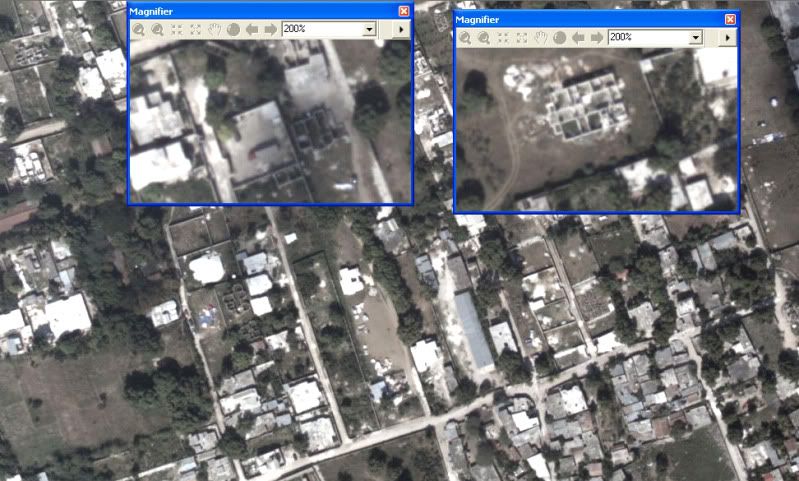
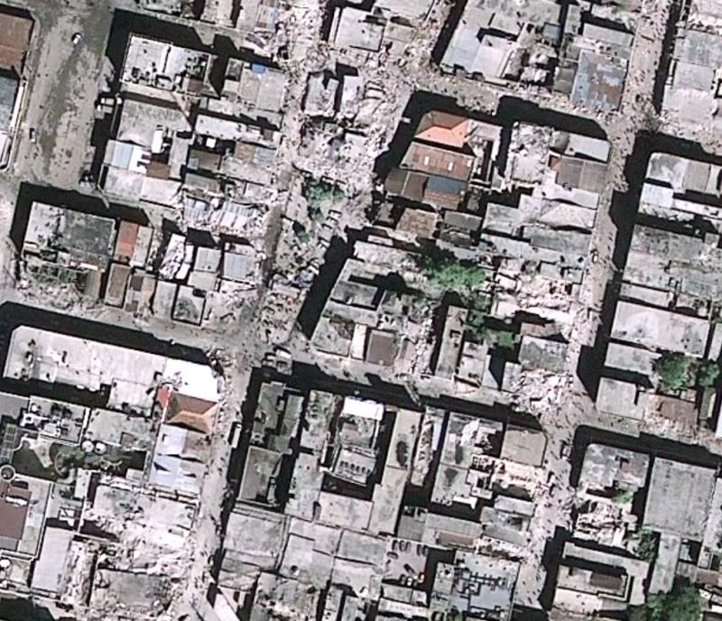
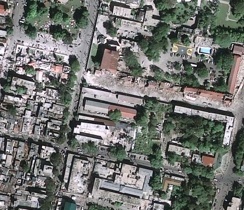
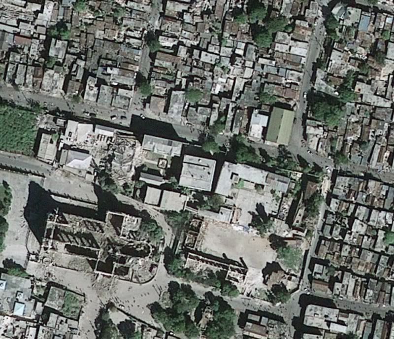
Free data and information related to Haiti and earthquake including post-event imagery from GeoEye (as a layer, in a map document, or as a web app for data download – see samples of imagery below). Click on the Content tab to see what is available. Update 1-20-10: Data are continually being added here. When I first made this post there were 7 items, today there are 24 – keep it coming!
Add Additional Data to ArcGIS Online: http://blogs.esri.com/Support/blogs/arcgisonline/archive/2010/01/15/adding-content-to-arcgis-online.aspx
So you have access to some data or maps related to the Haiti Quake and are wondering how you can share it? The post linked above steps you through the process with ArcGIS Online.
Geoss Viewer: http://geoss.esri.com/geoviewer/
Follow Tweets within a drawn radius area, display geoRSS feeds from USGS and other groups, compute population within drawn area, and more.
Disaster Response and Assistance: http://www.esri.com/services/disaster-response/earthquakes/index.html
Free temporary software, data, imagery technical support and other resources to help people supporting the disaster response and recovery efforts in Haiti.
Web APIs free for non-commercial use: http://resources.esri.com/arcgisserver/index.cfm?fa=applications
These web API’s allow you to pull data from the Cloud and mash it up with other sources of data. Pick your flavor – Flex, Silverlight, JaveScript, .NET, or Java.
ArcGIS Online data for Desktop use or Web use – no cost for non-commercial use (Standard services): http://www.esri.com/software/arcgis/arcgisonline/map-services.html
Imagery, streets, political, etc – global data
World Geocoding and World Routing available as Task Services – no-cost for non-commercial use: http://www.esri.com/software/arcgis/arcgisonline/task-services.html
Use in ArcGIS Desktop or free web mapping APIs
Sample images from GeoEye imagery of Haiti, post Jan 2010 earthquake (click for larger image)


